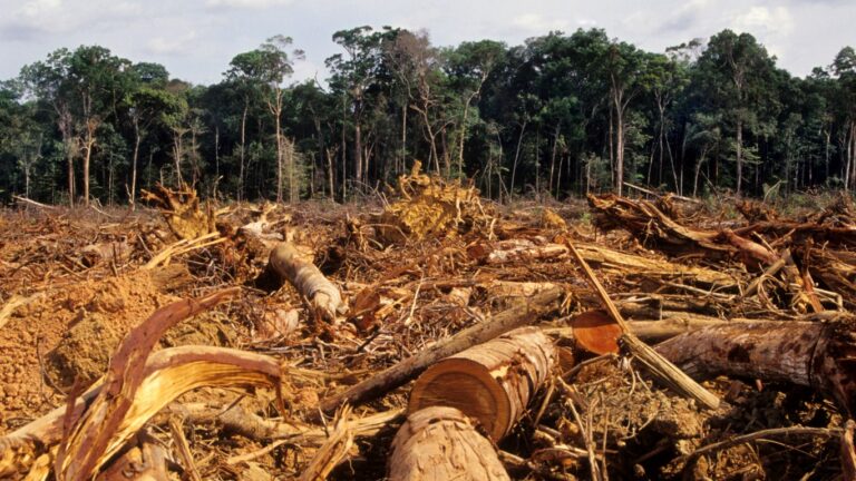
The U.S. States Losing the Most Forest

Forest land is rapidly disappearing in the United States. According to a recent report from the U.S. Forest Monitor, a collaborative research program involving The Nature Conservancy, the Open Space Institute, and the Land Trust Alliance, the U.S. lost the equivalent of a football field of forest land every two minutes between 1990 and 2017. Cumulatively, nearly 10 million acres nationwide were deforested over that 28 year period, an area roughly equal to the combined land area of Massachusetts and New Jersey.
Deforestation typically occurs for the express purpose of creating new cropland or the development of residential or commercial real estate. But such development initiatives come at a steep environmental cost. Estimates from the U.S. Forest Monitor shows that deforestation resulted in approximately 2.3 billion additional metric tons of greenhouse gases in the Earth’s atmosphere between 1990 and 2017, roughly equal to the total annual carbon emissions of the entire European Union, according to the World Bank.
While deforestation has occurred in all 50 states, the South and Southeastern U.S. accounts for the bulk of the decline. Just 10 states in that region lost nearly 6.6 million acres of forest land between 1990 and 2017, more than two-thirds of all deforestation nationwide over that period.
Using data from the U.S. Forest Monitor, Climate Crisis 247 identified the states where forests are disappearing fastest. We ranked all states with available data on the average annual rate of deforestation between 1990 and 2017. Only the 10 highest ranking states appear on this list. Supplemental data on population change is from the U.S. Census Bureau. All other data is as reported by the U.S. Forest Monitor.

10. South Carolina
- Average annual forest loss: 15,717 acres per year
- Total forest loss, 1990-2017: 439,972 acres
- Total climate burden of deforestation: 118.3 million additional metric tons of greenhouse gasses
- Land use in deforested areas: 42% cropland; 58% development
- State population change, 1990-2017: +44.1% (+1,538,059 people)
9. Missouri
- Average annual forest loss: 16,210 acres per year
- Total forest loss, 1990-2017: 453,789 acres
- Total climate burden of deforestation: 67.1 million additional metric tons of greenhouse gasses
- Land use in deforested areas: 83% cropland; 17% development
- State population change, 1990-2017: +19.5% (+996,631 people)
8. Mississippi
- Average annual forest loss: 16,294 acres per year
- Total forest loss, 1990-2017: 456,143 acres
- Total climate burden of deforestation: 104.1 million additional metric tons of greenhouse gasses
- Land use in deforested areas: 69% cropland; 31% development
- State population change, 1990-2017: +15.9% (+408,625 people)
7. Virginia
- Average annual forest loss: 17,631 acres per year
- Total forest loss, 1990-2017: 493,550 acres
- Total climate burden of deforestation: 130.2 million additional metric tons of greenhouse gasses
- Land use in deforested areas: 61% cropland; 39% development
- State population change, 1990-2017: +36.9% (+2,280,823 people)
6. Alabama
- Average annual forest loss: 19,811 acres per year
- Total forest loss, 1990-2017: 554,578 acres
- Total climate burden of deforestation: 123.5 million additional metric tons of greenhouse gasses
- Land use in deforested areas: 79% cropland; 21% development
- State population change, 1990-2017: +20.7% (+834,358 people)
5. Arkansas
- Average annual forest loss: 20,604 acres per year
- Total forest loss, 1990-2017: 576,794 acres
- Total climate burden of deforestation: 108 million additional metric tons of greenhouse gasses
- Land use in deforested areas: 72% cropland; 28% development
- State population change, 1990-2017: +27.8% (+653,655 people)
4. Florida
- Average annual forest loss: 23,490 acres per year
- Total forest loss, 1990-2017: 657,568 acres
- Total climate burden of deforestation: 130.5 million additional metric tons of greenhouse gasses
- Land use in deforested areas: 45% cropland; 55% development
- State population change, 1990-2017: +62.2% (+8,046,329 people)
3. North Carolina
- Average annual forest loss: 28,563 acres per year
- Total forest loss, 1990-2017: 799,601 acres
- Total climate burden of deforestation: 205.8 million additional metric tons of greenhouse gasses
- Land use in deforested areas: 53% cropland; 47% development
- State population change, 1990-2017: +54.9% (+3,640,971 people)
2. Texas
- Average annual forest loss: 34,783 acres per year
- Total forest loss, 1990-2017: 973,710 acres
- Total climate burden of deforestation: 192.2 million additional metric tons of greenhouse gasses
- Land use in deforested areas: 41% cropland; 59% development
- State population change, 1990-2017: +66.6% (+11,318,261 people)
1. Georgia
- Average annual forest loss: 42,223 acres per year
- Total forest loss, 1990-2017: 1,181,991 acres
- Total climate burden of deforestation: 291.3 million additional metric tons of greenhouse gasses
- Land use in deforested areas: 53% cropland; 47% development
- State population change, 1990-2017: +61.0% (+3,951,230 people)
More from ClimateCrisis 247
- Which U.S. Cities Produce the Most Emissions Per Resident?
- How Oil Money Failed to Save Climate-Denying Lawmakers in 2026
- NFL Teams Most Exposed to Severe Weather in November
- States With The Most Dangerous Weather