The Cities Where Flooding Is at Historic Extremes Right Now
 https://climate-crisis-247-bucket.nyc3.cdn.digitaloceanspaces.com/wp-content/uploads/2025/05/07221331/whs7fpfkwq-1-150x150.jpg
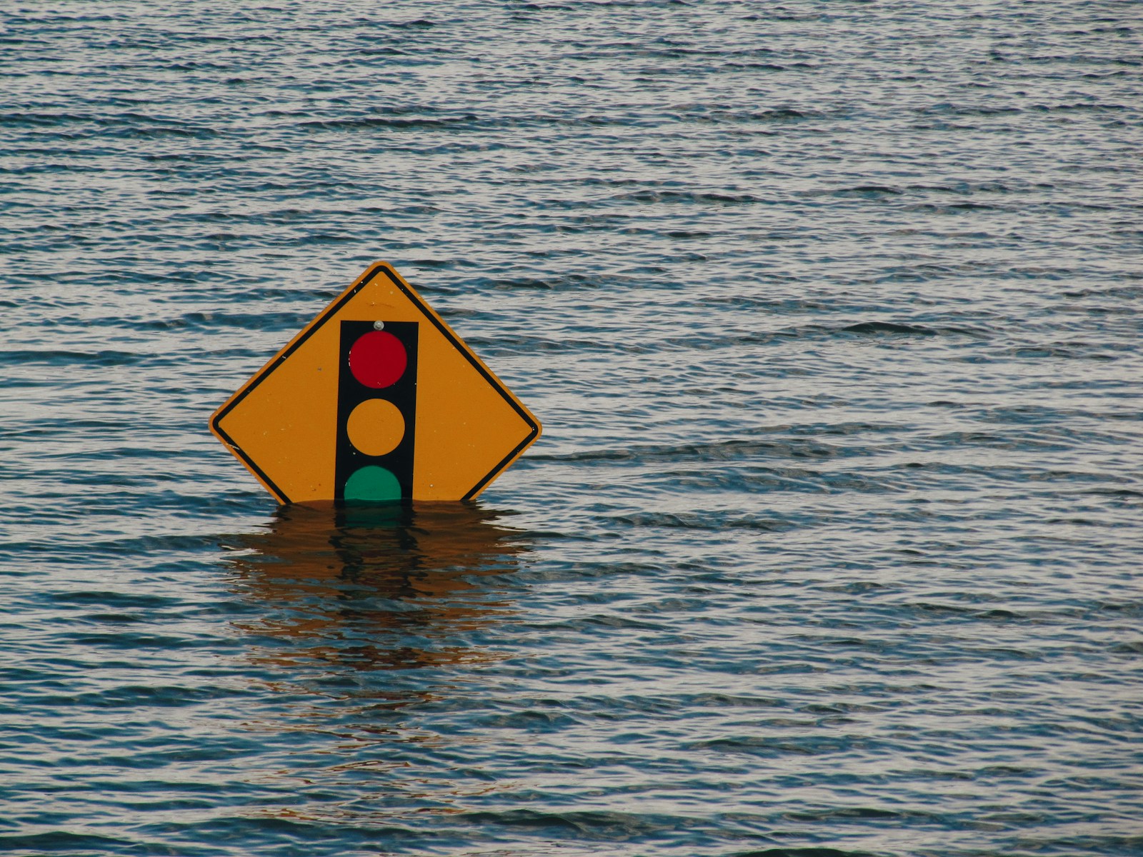
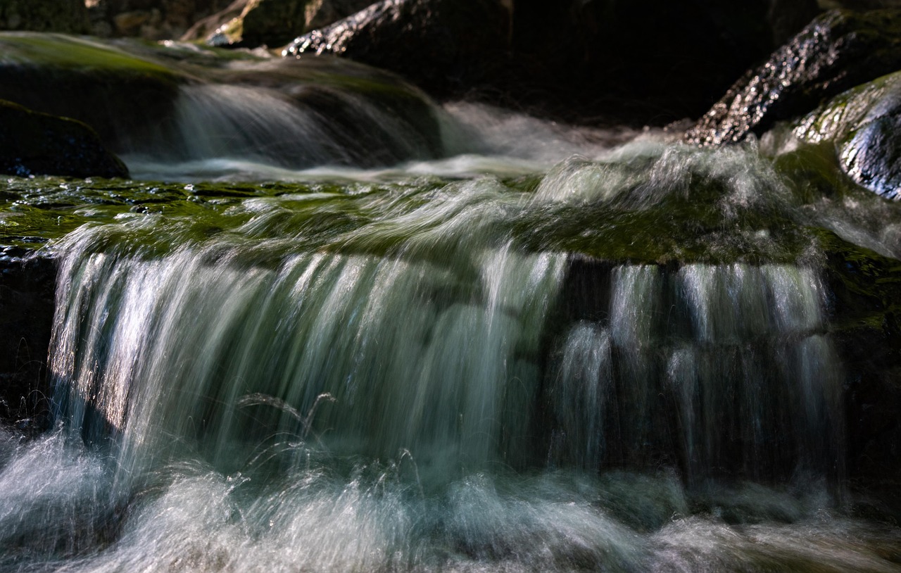
In the past week, the United States experienced several severe weather events, including heavy rainfall, flooding, and tornadoes, impacting various regions across the country. Two storm systems over the past week produced widespread heavy rainfall across the Corn Belt, with some areas receiving over four inches of rain. Meanwhile, a slow-moving storm system brought torrential rains to the Mid-Atlantic, leading to flash flood emergencies in parts of Virginia and Maryland. In Albemarle County, Virginia, a 12-year-old boy tragically died after being swept away by floodwaters.
Tesla takedown? A Timeline of Tesla Vandalism in the United States
Not in Kansas anymore? Tornado Alley Is Expanding South Into These Cities
Last week, more than 345 counties were under flood watches and warnings issued by the National Weather Service, representing over 36 million Americans. At some observation stations, current streamflow levels are at record highs, and water levels are multiple feet above flooding thresholds. A closer look at real-time data from the U.S. Geological Survey reveals the places where flooding is the worst right now.
To determine where flooding is at historic extremes right now, Climate Crisis 247 reviewed data on current flooding observations from the U.S. Geological Survey. Stations were ranked based on the historic percentile of current streamflow. Stations where current streamflow conditions are in the highest percentile – meaning where streamflow levels are at their most record-breaking – were ranked highest. Supplemental data on current water levels and flooding thresholds are also from the USGS. Station locations were paired to Census Bureau places using nearest neighbor analysis.
25. Kinnickinnic River at Milwaukee, WI (Milwaukee County)

- Current streamflow: 168.0 cubic feet per second (97.56th percentile)
- Current water level: 7.50 feet
- Flooding threshold: 16.00 feet
24. South River at Stonecrest, GA (DeKalb County)

- Current streamflow: 2,610.0 cubic feet per second (97.56th percentile)
- Current water level: 7.88 feet
- Flooding threshold: 12.00 feet
23. Chattahoochee River at Atlanta, GA (Fulton County)
Current streamflow: 9,220.0 cubic feet per second (97.73rd percentile)
Current water level: 14.17 feet
Flooding threshold: 24.00 feet
22. Sugar Creek at Edinburgh, IN (Johnson County)
- Current streamflow: 3,300.0 cubic feet per second (97.74rd percentile)
- Current water level: 8.55 feet
- Flooding threshold: 10.00 feet
21. Edisto River at Ridgeville, SC (Dorchester County)

- Current streamflow: 5,570.0 cubic feet per second (97.84th percentile)
- Current water level: 10.24 feet
- Flooding threshold: 10.00 feet
20. Blackstone River at Upton, MA (Worcester County)
- Current streamflow: 1,000.0 cubic feet per second (97.87th percentile)
- Current water level: 4.13 feet
- Flooding threshold: 9.00 feet
19. Flatrock River at St. Paul, IN (Decatur County)

- Current streamflow: 2,000.0 cubic feet per second (97.91th percentile)
- Current water level: 3.61 feet
- Flooding threshold: 6.00 feet
18. Harpeth River at Franklin, TN (Williamson County)
- Current streamflow: 5,580.0 cubic feet per second (98.00th percentile)
- Current water level: 20.06 feet
- Flooding threshold: 30.00 feet
17. Yellow River at Mountain Park, GA (Gwinnett County)
- Current streamflow: 1,200.0 cubic feet per second (98.04th percentile)
- Current water level: 9.17 feet
- Flooding threshold: 23.00 feet
16. Eagle Creek at Zionsville, IN (Boone County)
- Current streamflow: 778.0 cubic feet per second (98.22st percentile)
- Current water level: 3.85 feet
- Flooding threshold: 9.00 feet
15. North Meherrin River at Lunenburg, VA (Lunenburg County)
- Current streamflow: 464.0 cubic feet per second (98.27th percentile)
- Current water level: 4.57 feet
- Flooding threshold: 14.00 feet
14. East Fork Whitewater River at Abington, IN (Wayne County)

- Current streamflow: 1,380.0 cubic feet per second (98.31st percentile)
- Current water level: 5.93 feet
- Flooding threshold: 14.00 feet
13. South Skunk River at Ames, IA (Story County)
- Current streamflow: 3,720.0 cubic feet per second (98.33nd percentile)
- Current water level: 17.00 feet
- Flooding threshold: 21.50 feet
12. Cranes Nest River at Clintwood, VA (Dickenson County)
- Current streamflow: 299.0 cubic feet per second (98.36th percentile)
- Current water level: 3.95 feet
- Flooding threshold: 11.00 feet
11. Grand River at Little Eagle, SD (Corson County)
- Current streamflow: 9,040.0 cubic feet per second (98.48th percentile)
- Current water level: 15.34 feet
- Flooding threshold: 15.00 feet
10. White Lick Creek at Mooresville, IN (Morgan County)
- Current streamflow: 1,140.0 cubic feet per second (98.51st percentile)
- Current water level: 9.75 feet
- Flooding threshold: 17.00 feet
9. Moreau River at Whitehorse, SD (Dewey County)
- Current streamflow: 9,000.0 cubic feet per second (98.57th percentile)
- Current water level: 14.96 feet
- Flooding threshold: 21.00 feet
8. Little River at Maryville, TN (Blount County)
- Current streamflow: 2,200.0 cubic feet per second (98.63nd percentile)
- Current water level: 9.07 feet
- Flooding threshold: 18.00 feet
7. Clifty Creek at Hartsville, IN (Bartholomew County)
- Current streamflow: 1,190.0 cubic feet per second (98.68th percentile)
- Current water level: 4.31 feet
- Flooding threshold: 9.00 feet
6. Youngs Creek at Amity, IN (Johnson County)

- Current streamflow: 1,300.0 cubic feet per second (98.77th percentile)
- Current water level: 7.28 feet
- Flooding threshold: 7.00 feet
5. Harpeth River at Kingston Springs, TN (Cheatham County)
- Current streamflow: 12,100.0 cubic feet per second (98.80th percentile)
- Current water level: 15.12 feet
- Flooding threshold: 20.00 feet
4. Eagle Creek at Indianapolis, IN (Marion County)
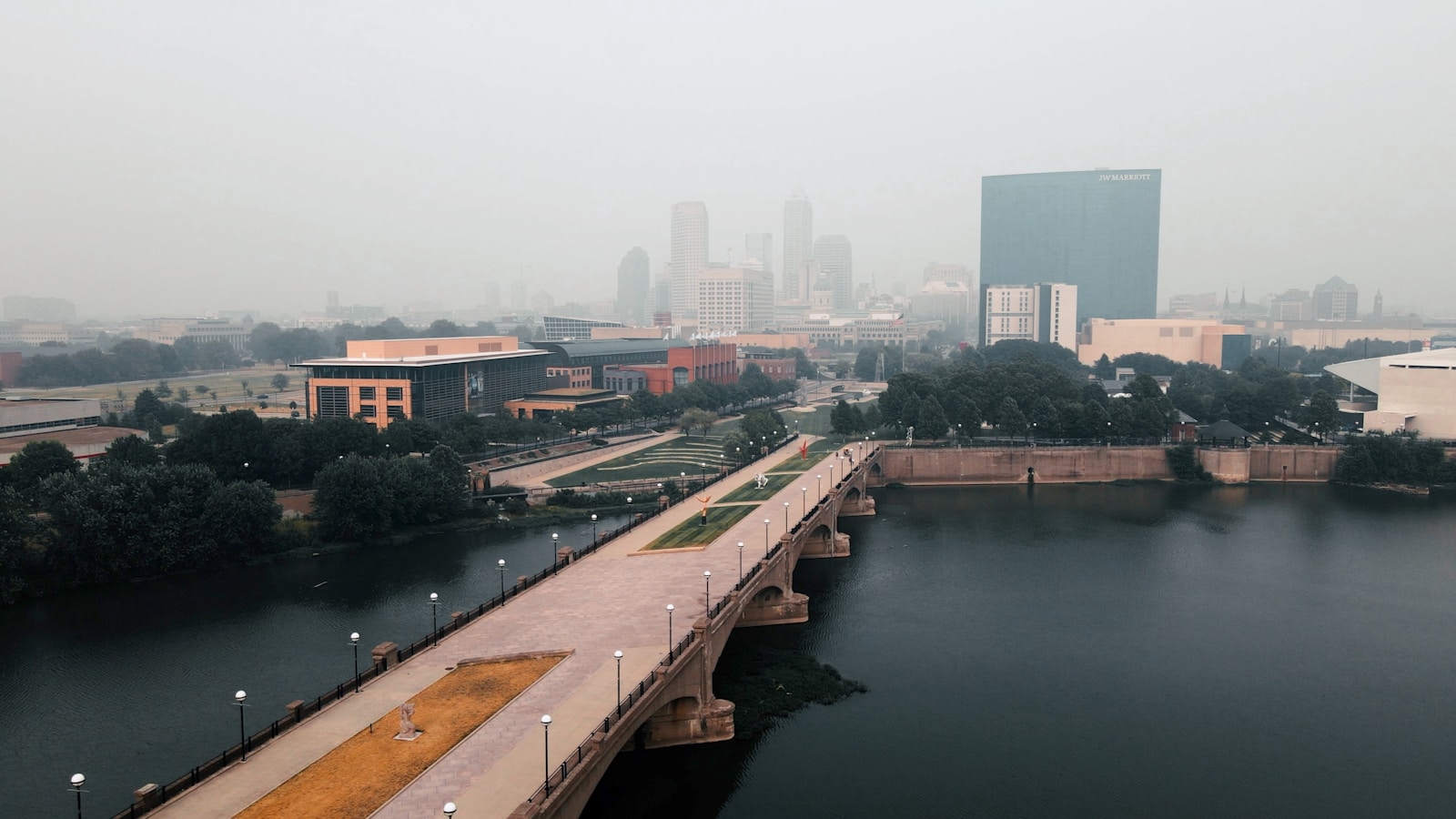
- Current streamflow: 1,220.0 cubic feet per second (98.84th percentile)
- Current water level: 4.39 feet
- Flooding threshold: 9.00 feet
3. Knife River at Hazen, ND (Mercer County)
- Current streamflow: 1,220.0 cubic feet per second (98.90th percentile)
- Current water level: 7.53 feet
- Flooding threshold: 21.00 feet
2. Meramec River at Sullivan, MO (Franklin County)

- Current streamflow: 13,700.0 cubic feet per second (98.92nd percentile)
- Current water level: 12.50 feet
- Flooding threshold: 11.00 feet
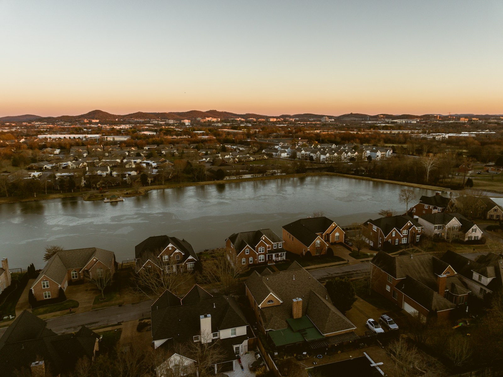
1. Harpeth River at Nashville, TN (Davidson County)

- Current streamflow: 11,000.0 cubic feet per second (98.92nd percentile)
- Current water level: 15.51 feet
- Flooding threshold: 20.00 feet
Sponsor
Find a Vetted Financial Advisor
- Finding a fiduciary financial advisor doesn't have to be hard. SmartAsset's free tool matches you with up to 3 financial advisors that serve your area in 5 minutes.
- Each advisor has been vetted by SmartAsset and is held to a fiduciary standard to act in your best interests. Get on the path toward achieving your financial goals!