Counties Where Forests Have Vanished

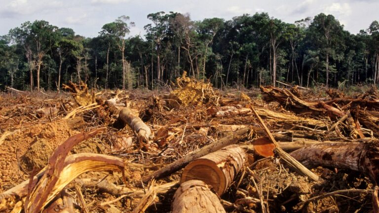
Forest land is rapidly disappearing in the United States. According to the U.S. Forest Monitor, the U.S. lost nearly 10 million acres of forest land between 1990 and 2017 — an expanse roughly equal to the combined land area of Massachusetts and New Jersey. That amounts to roughly one football field of forest lost every two minutes, and the environmental toll is staggering.
Forests are natural carbon sinks that absorb greenhouse gases, and since 1990, deforestation on this scale has added an estimated 2.3 billion metric tons of greenhouse gases to the atmosphere — roughly equal to the total annual carbon emissions of the European Union. Trees are typically cleared to make way for commercial or residential development, or for cropland, and as such, the phenomenon is by no means isolated to remote timber country.
In communities across the United States — particularly in the South — large swaths of forest land have been clear-cut for real estate or agriculture. Several counties lost 20% or more of their unprotected forestland in recent decades.
Using data from the U.S. Forest Monitor, a collaborative research program involving The Nature Conservancy, the Open Space Institute, and the Land Trust Alliance, Climate Crisis 247 identified the U.S. counties where forest land has vanished fastest. We ranked all counties with available data on the share of unprotected forestland that was clear-cut between 1990 and 2017. Only the 10 highest-ranking counties appear on this list, and independent cities were excluded from analysis. All supplemental data, including figures used in these calculations, are also from the U.S. Forest Monitor.

10. Fulton County, Georgia
- Share of local forestland lost, 1990-2017: 19.8% (29,159 total acres)
- Average annual forest loss in county: 1,041 acres per year
- Forestland as share of county land area: 34.6% (43.1% in 1990)
- Total climate burden of deforestation: 7.9 million additional metric tons of greenhouse gasses
- Est. time until all forests are completely gone at current rate: 114 years
9. Terry County, Texas
- Share of local forestland lost, 1990-2017: 21.1% (152 total acres)
- Average annual forest loss in county: 5 acres per year
- Forestland as share of county land area: 0.1% (0.1% in 1990)
- Total climate burden of deforestation :N/A
- Est. time until all forests are completely gone at current rate: 114 years
8. Forsyth County, Georgia
- Share of local forestland lost, 1990-2017: 21.7% (16,532 total acres)
- Average annual forest loss in county: 590 acres per year
- Forestland as share of county land area: 37.7% (48.2% in 1990)
- Total climate burden of deforestation: 4.4 million additional metric tons of greenhouse gasses
- Est. time until all forests are completely gone at current rate: 101 years
7. DeKalb County, Georgia
- Share of local forestland lost, 1990-2017: 21.9% (9,474 total acres)
- Average annual forest loss in county: 338 acres per year
- Forestland as share of county land area: 19.5% (25.0% in 1990)
- Total climate burden of deforestation: 2.7 million additional metric tons of greenhouse gasses
- Est. time until all forests are completely gone at current rate: 100 years
6. Clayton County, Georgia
- Share of local forestland lost, 1990-2017: 25.1% (6,833 total acres)
- Average annual forest loss in county: 244 acres per year
- Forestland as share of county land area: 22.0% (29.4% in 1990)
- Total climate burden of deforestation: 1.9 million additional metric tons of greenhouse gasses
- Est. time until all forests are completely gone at current rate: 83 years
5. Mecklenburg County, North Carolina
- Share of local forestland lost, 1990-2017: 27.4% (25,497 total acres)
- Average annual forest loss in county: 911 acres per year
- Forestland as share of county land area: 19.3% (26.6% in 1990)
- Total climate burden of deforestation: 7.3 million additional metric tons of greenhouse gasses
- Est. time until all forests are completely gone at current rate: 74 years
4. Broward County, Florida
- Share of local forestland lost, 1990-2017: 27.7% (1,927 total acres)
- Average annual forest loss in county: 69 acres per year
- Forestland as share of county land area: 0.6% (0.8% in 1990)
- Total climate burden of deforestation: 381,485 additional metric tons of greenhouse gasses
- Est. time until all forests are completely gone at current rate: x73 years
3. Cobb County, Georgia
- Share of local forestland lost, 1990-2017: 28.0% (15,954 total acres)
- Average annual forest loss in county: 570 acres per year
- Forestland as share of county land area: 18.6% (25.8% in 1990)
- Total climate burden of deforestation: 4.4 million additional metric tons of greenhouse gasses
- Est. time until all forests are completely gone at current rate: 72 years
2. Harris County, Texas
- Share of local forestland lost, 1990-2017: 29.3% (44,781 total acres)
- Average annual forest loss in county: 1,599 acres per year
- Forestland as share of county land area: 9.5% (13.4% in 1990)
- Total climate burden of deforestation: 10.8 million additional metric tons of greenhouse gasses
- Est. time until all forests are completely gone at current rate: 68 years
1. Gwinnett County, Georgia
- Share of local forestland lost, 1990-2017: 30.1% (26,307 total acres)
- Average annual forest loss in county: 940 acres per year
- Forestland as share of county land area: 21.8% (31.2% in 1990)
- Total climate burden of deforestation: 7.1 million additional metric tons of greenhouse gasses
- Est. time until all forests are completely gone at current rate: 65 years
More from ClimateCrisis 247
- Cities Least Likely To Get Snow This Year
- The 15 Countries That Have Seen Pollution Increase The Most
- Global Warming Remains Unchecked, Experts Warn at UN’s COP31 Climate Summit
- 10 Coastal Counties Americans are Leaving