Which US Cities Are the Most Naturally Diverse?
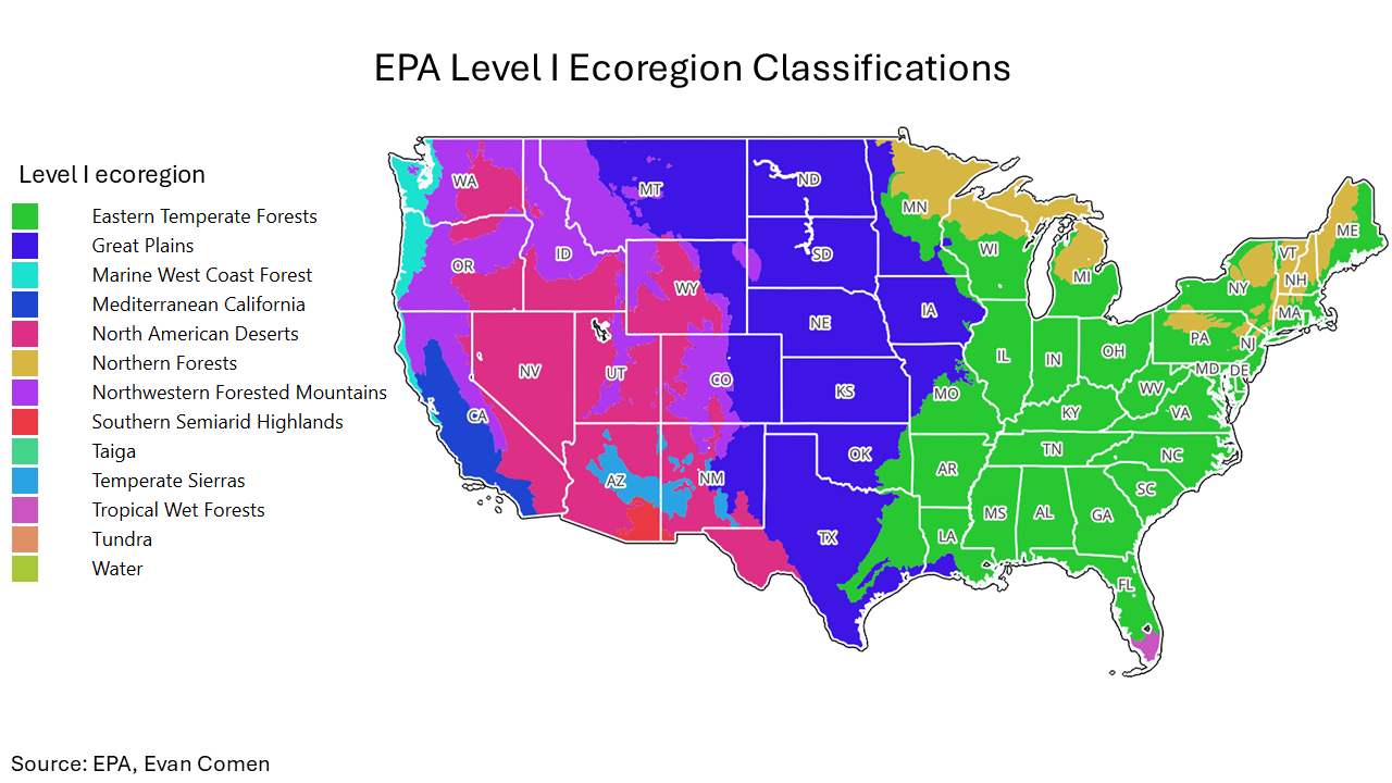
The Environmental Protection Agency divides the contiguous United States into dozens of ecoregions – units defined by shared climate, soil, vegetation, and geomorphology. At the broadest scale, most of the U.S. population is concentrated in just three major regions: the Eastern Temperate Forests, the Great Plains, and the Southern Semiarid Highlands.
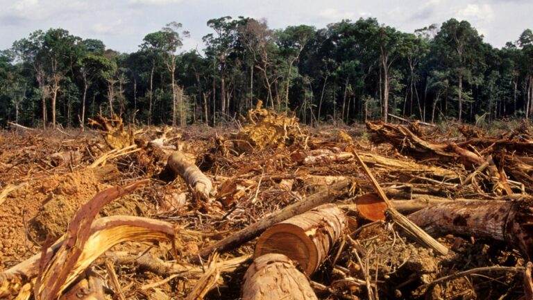
A more granular classification, however, reveals a mosaic of 967 Level IV ecoregions across the country, ranging from the temperate rainforests of the Pacific Northwest and the alpine zones of the Rockies to the xeric basins of the Southwest, the tallgrass prairies of the Midwest, and the tidal wetlands of the Southeast. This fine-scale ecological variation underlies substantial differences in natural hazards, agricultural suitability, biodiversity, and infrastructure demands, factors that influence urban development and local economic dynamics.
While many cities fall entirely within a single ecoregion, a subset of urban areas span multiple ecological zones. These cities often face a more complex mix of environmental conditions, from varied topographies and microclimates to differing soil types and watershed characteristics. Large metros like New York encompass several ecoregions, but smaller cities located along transition zones – such as the Atlantic Seaboard Fall Line, basin-and-range boundaries, or coastal–inland interfaces – can also exhibit high ecological diversity within relatively compact footprints. A closer look at the data identifies the cities that overlap the most unique ecoregions, revealing the cities with the greatest natural diversity.
To determine the cities with the most natural diversity, Climate Crisis 247 reviewed data on ecoregions from the EPA. Cities were ranked based on the number of Level IV ecoregions overlapping with their spatial boundaries. City boundaries are from the U.S. Census Bureau and are for 2023.
10. Columbus, GA
Columbus spans five distinct ecoregions along Georgia’s Fall Line, where the Piedmont transitions into the Coastal Plain. Its boundaries encompass the Sand Hills, Southern Outer Piedmont, Fall Line Hills, Southern Hilly Gulf Coastal Plain, and Southeastern Floodplains and Low Terraces. This results in a varied mix of soils, vegetation communities, and ecological conditions within a compact area.
9. Fayetteville, NC
Fayetteville also spans five Level IV ecoregions, reflecting its position within a diverse section of the North Carolina Coastal Plain. The city includes portions of the Atlantic Southern Loam Plains, Sand Hills, Rolling Coastal Plain, Carolina Flatwoods, and Southeastern Floodplains and Low Terraces. This blend creates a range of landscapes from sandy uplands to broad flatwoods and floodplain systems.
8. San Jose, CA
San Jose stretches across five distinct ecoregions across the varied terrain of the southern San Francisco Bay Area. Its boundaries include the Bay Terraces/Lower Santa Clara Valley, East Bay Hills/Western Diablo Range, Bay Flats, Leeward Hills, and Upper Santa Clara Valley. Together, these zones encompass everything from low-lying baylands to foothill slopes and interior valleys.
7. Buckeye, AZ
Buckeye covers six ecoregions within the Sonoran Desert and surrounding basin-and-range country. The city includes Central Sonoran and Colorado Desert Basins, Arizona Upland and Eastern Sonoran Mountains and Basins, Central Sonoran/Colorado Desert Mountains, and the Middle Gila/Salt River Floodplains. This results in a mosaic of desert lowlands, mountain foothills, and riparian corridors.
6. Fairfield, CA
Fairfield spans six ecoregions at the intersection of the Bay Area, Delta, and North Coast geomorphic provinces. These include the Suisun Terraces and Low Hills, Foothill Ridges and Valleys, East Bay Hills/Western Diablo Range, Napa-Sonoma-Lake Volcanic Highlands, Yolo Alluvial Fans, and Delta. The combination brings together tidal marshlands, volcanic uplands, and inland alluvial landscapes.
5. Salt Lake City, UT
Salt Lake City encompasses six ecoregions shaped by the meeting of the Great Basin and the Wasatch Range. Its boundaries include the Moist Wasatch Front Footslopes, Salt Deserts, Semiarid Foothills, Shadscale-Dominated Saline Basins, Wasatch Montane Zone, and Wetlands. This results in sharp ecological gradients from saline lowlands to forested mountain slopes.

4. Colorado Springs, CO
Colorado Springs spans six ecoregions along the transition from the Southern Rockies to the High Plains. The city includes Foothill Grasslands, Foothill Shrublands, Piedmont Plains and Tablelands, Crystalline Mid-Elevation Forests, Pine-Oak Woodlands, and Pinyon–Juniper Woodlands and Savannas. These overlapping zones support a broad range of elevation-driven habitats.
3. New York, NY
New York City spans six distinct ecoregions across its varied coastal and glaciated terrain. These include the Long Island Sound Coastal Lowland, Southern New England Coastal Plains and Hills, Glaciated Triassic Lowlands, Barrier Islands/Coastal Marshes, Hackensack Meadowlands, and Trap Rock and Conglomerate Uplands. As a result, the city’s footprint includes everything from tidal wetlands and barrier beaches to rocky uplands and glacial plains.
2. Butte, MT
Butte spans seven ecoregions within a complex mix of intermontane basins and mountain ranges. The city’s territory includes the Elkhorn Mountains–Boulder Batholith, Dry Intermontane Sagebrush Valleys, Eastern Pioneer Sedimentary Mountains, Pioneer–Anaconda Ranges, Dry Gneissic–Schistose–Volcanic Hills, Deer Lodge–Philipsburg–Avon Grassy Intermontane Hills and Valleys, and Townsend Basins. This geomorphic variety creates a wide range of ecological settings within a relatively small region.
1. Anaconda, MT
Anaconda spans eight ecoregions, the most of any U.S. city. Its boundaries include the Pioneer–Anaconda Ranges, Flint Creek–Anaconda Mountains, Deer Lodge–Philipsburg–Avon Grassy Intermontane Hills and Valleys, Big Hole, Alpine Zone, Elkhorn Mountains–Boulder Batholith, Eastern Batholith, and Eastern Pioneer Sedimentary Mountains. This unusual overlap brings together alpine environments, volcanic and granitic uplands, intermontane valleys, and rugged mountain systems.
Sponsor
Find a Vetted Financial Advisor
- Finding a fiduciary financial advisor doesn't have to be hard. SmartAsset's free tool matches you with up to 3 financial advisors that serve your area in 5 minutes.
- Each advisor has been vetted by SmartAsset and is held to a fiduciary standard to act in your best interests. Get on the path toward achieving your financial goals!