National Parks Most At Risk From Climate Change
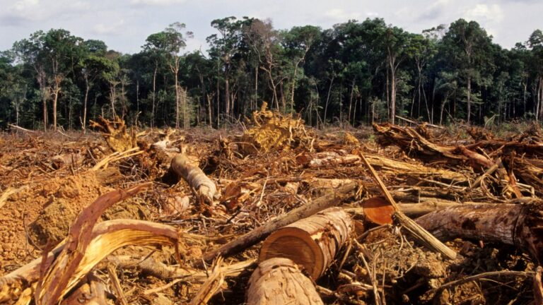
The National Park System was established in 1916. It encompasses 433 parks and protected areas covering 85 million acres. Many of these parks face growing threats from climate change, as illustrated most recently by the Dragon Bravo Fire in Grand Canyon National Park. Burning from July 4 to September 29 of last year, the fire cost $135 million to suppress.
In 2025, major fires also broke out in Gunnison, Olympic, Yellowstone, and Sequoia & Kings Canyon National Parks, threatening giant sequoias — the largest trees in the world.
What is driving these fires? According to the Wilderness Society, “One of the main forces driving this trend is climate change, which has intensified summertime droughts, reduced the mountaintop snowpack, making fire seasons longer, and even increased lightning strikes that can trigger big fires in tinder-dry forests.”
The largest wildfire in National Park System history swept through Yellowstone in 1988, burning 793,880 acres — roughly a third of the park. Suppression efforts cost approximately $120 million and required 9,000 firefighters supported by 4,000 soldiers.
Fire, however, is not the only threat facing national parks. Flooding and human encroachment have severely damaged the Everglades. According to the Florida Museum, Everglades National Park is often called “the most threatened park in the U.S.”
To identify the parks most at risk from climate change, we examined data, news reports, and official documents focused on clear and present dangers. Our sources included the National Park Service’s own evaluations; Climate Central’s comprehensive analysis, “Our Changing National Parks“; the National Parks Conservation Association’s “Air and Climate Report: Polluted Parks“; and the National Park Service’s internal climate vulnerability assessment, NPVuln. The organization Climate Impacts has also issued a report titled “How the Climate Crisis Is Affecting National Parks,” in which the authors conclude that “climate change is the greatest threat the national parks have ever faced.”
The parks we reviewed face a range of climate-driven hazards: glacial melt, sea-level rise, extreme heat, drought, and wildfire. For context, we have included each park’s size and founding year. The largest park in the system, Wrangell-St. Elias National Park & Preserve in Alaska, covers 13,175,799 acres; the smallest, Gateway Arch National Park in Missouri, covers just 192 acres.
These are the most endangered parks:
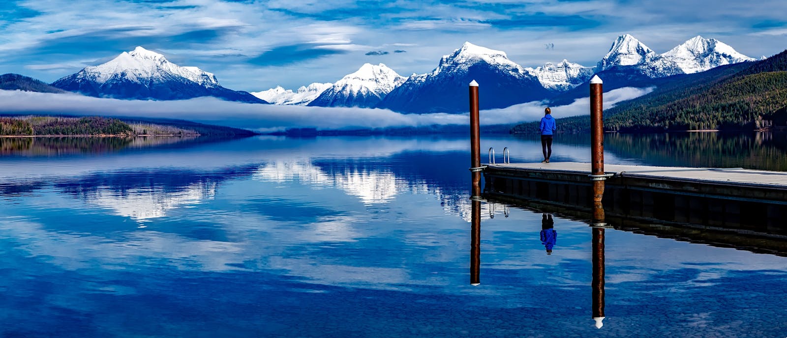
Glacier National Park (Montana) | 1,583 sq mi (1,013,322 acres) | Est. May 11, 1910 Rapidly melting glaciers and reduced snowpack are threatening the park’s fragile alpine ecosystems.
Everglades National Park (Florida) | 2,357 sq mi (1,508,000 acres) | Est. December 6, 1947 Rising sea levels risk inundating freshwater habitats, altering salinity levels, and damaging mangroves and wildlife.
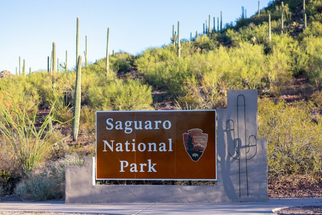
Saguaro National Park (Arizona) | 143 sq mi (91,327 acres) | Est. October 14, 1994 (originally designated a national monument in 1933) Extreme heat and prolonged drought are stressing saguaro cacti and other desert species.
Joshua Tree National Park (California) | 1,234 sq mi (789,745 acres) | Est. October 31, 1994 (originally designated a national monument in 1936) Rising temperatures and drought may push Joshua trees beyond their viable range within parts of the park.
Great Smoky Mountains National Park (Tennessee/North Carolina) | 816 sq mi (522,419 acres) | Est. June 15, 1934 Warming temperatures are affecting high-elevation spruce-fir forests, with projections showing sharp increases in extreme heat days. The park is also the most visited in the national park system.
Yosemite National Park (California) | 1,189 sq mi (761,266 acres) | Est. October 1, 1890 The park faces significant projected increases in extreme heat days, wildfire risk, and broader ecosystem shifts across its Sierra Nevada landscapes.
Note: Area figures reflect primary land areas based on current NPS boundaries and exclude some small water bodies. Additional parks flagged in climate vulnerability reports include Sequoia/Kings Canyon for giant sequoia fire risk and Cape Hatteras for coastal erosion.