US Cities With Most Homes At Hurricane Risk, According to new Report
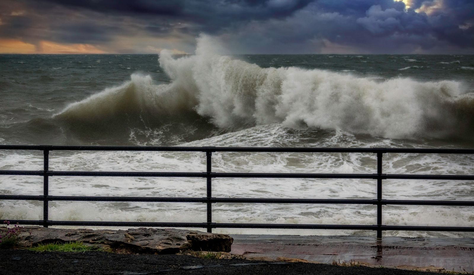
Earlier this month, Hurricane Lala passed the southern coast of Hawaii as a category 1 storm. Lala brought over 20 inches of rain, coastal storm surges, and high winds to the island of Hawaii as well as parts of Maui and Oahu. While the storm narrowly missed making landfall on the Big Island, it led to widespread flooding, damaged homes and roadways, and left hundreds of thousands without power. On the other side of the country, however, the 2026 hurricane season has–so far–been relatively quiet.
According to the National Oceanic and Atmospheric Administration, there are an average of 14 named storms in the Atlantic basin each year. As of early August, two months into the 2026 hurricane season, there have been only two named storms, and NOAA meteorologists forecast a 75% chance of below-average Atlantic hurricane activity for the rest of the year.
Still, the peak of hurricane season is only weeks away, and as history has demonstrated time and again, a single storm that makes landfall near a major population center can be catastrophic. Certain cities along the Atlantic and Gulf coasts are especially exposed, with tens, or even hundreds, of thousands of homes at moderate or severe risk of hurricane-related storm surges.
Using data from Coality’s 2026 Hurricane Risk Report Climate Crisis 247 identified the most vulnerable cities in this year’s hurricane season. We ranked the 10 U.S. metro areas where the most homes are identified as being at moderate to severe risk of hurricane storm surges. Supplemental data on the estimated reconstruction cost value of at-risk homes is also from Coality. For each city on this list, we also reviewed projected future sea level rise and flood risk, under both current pollution controls and unchecked pollution, using data from the Coastal Risk Finder. Additional data on major hurricanes that have previously impacted these places are as reported by NOAA’s Billion-Dollar Weather and Climate Disasters program.
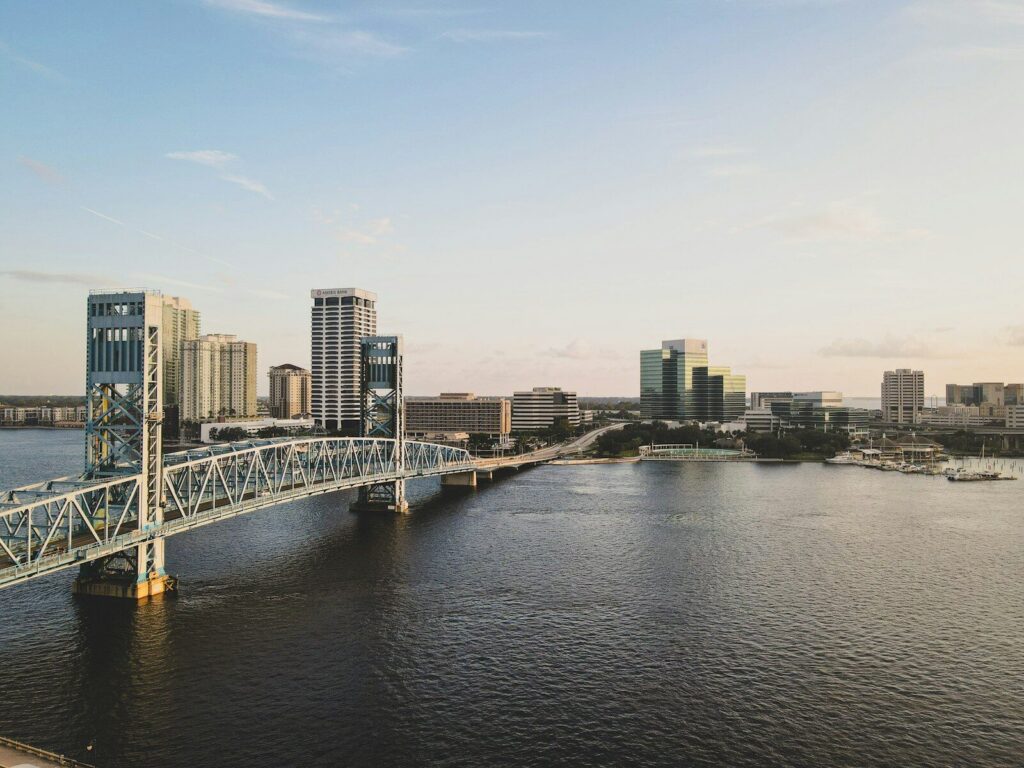
10. Jacksonville, FL metro area
- Homes at moderate to severe risk of storm surge damage: 199,506 ($69.8 billion reconstruction cost value)
- Projected sea level rise in Jacksonville by 2100: 2.3 ft. with current pollution standards; 3.0 ft. with unchecked pollution
- Projected flooding in Jacksonville by 2050: 2.7 ft. flood annually with current pollution standards; 2.8 ft. flood annually with unchecked pollution
- Most destructive hurricane to impact Jacksonville since 1980: Hurricane Irma in 2017; cat. 4 in local region
- Total fatalities and damage caused by Hurricane Irma: 97 deaths, $64.0 billion in damage
9. Naples, FL metro area
- Homes at moderate to severe risk of storm surge damage: 200,069 ($66.3 billion reconstruction cost value)
- Projected sea level rise in Naples by 2100: 2.3 ft. with current pollution standards; 3.0 ft. with unchecked pollution
- Projected flooding in Naples by 2050: 2.4 ft. flood annually with current pollution standards; 2.4 ft. flood annually with unchecked pollution
- Most destructive hurricane to impact Naples since 1980: Hurricane Milton in 2024; cat. 3 in local region
- Total fatalities and damage caused by Hurricane Milton: 32 deaths, $34.3 billion in damage
8. Virginia Beach, VA-NC metro area
- Homes at moderate to severe risk of storm surge damage: 203,058 ($72.4 billion reconstruction cost value)
- Projected sea level rise in Virginia Beach by 2100: 2.9 ft. with current pollution standards; 3.6 ft. with unchecked pollution
- Projected flooding in Virginia Beach by 2050: 3.2 ft. flood annually with current pollution standards; 3.3 ft. flood annually with unchecked pollution
- Most destructive hurricane to impact Virginia Beach since 1980: Hurricane N/A in N/A; cat. N/A in local region
- Total fatalities and damage caused by Hurricane N/A: N/A deaths, $N/A billion in damage
7. North Port, FL metro area
- Homes at moderate to severe risk of storm surge damage: 251,753 ($75.8 billion reconstruction cost value)
- Projected sea level rise in North Port by 2100: 2.3 ft. with current pollution standards; 3.0 ft. with unchecked pollution
- Projected flooding in North Port by 2050: 2.4 ft. flood annually with current pollution standards; 2.5 ft. flood annually with unchecked pollution
- Most destructive hurricane to impact North Port since 1980: Hurricane Ian in 2022; cat. 4 in local region
- Total fatalities and damage caused by Hurricane Ian: 152 deaths, $119.6 billion in damage
6. Houston,TX metro area
- Homes at moderate to severe risk of storm surge damage: 254,825 ($83.9 billion reconstruction cost value)
- Projected sea level rise in Houston by 2100: 3.3 ft. with current pollution standards; 4.0 ft. with unchecked pollution
- Projected flooding in Houston by 2050: 3.2 ft. flood annually with current pollution standards; 3.2 ft. flood annually with unchecked pollution
- Most destructive hurricane to impact Houston since 1980: Hurricane Harvey in 2017; cat. 4 in local region
- Total fatalities and damage caused by Hurricane Harvey: 89 deaths, $160.0 billion in damage
5. Cape Coral, FL metro area
- Homes at moderate to severe risk of storm surge damage: 324,621 ($99.0 billion reconstruction cost value)
- Projected sea level rise in Cape Coral by 2100: 2.3 ft. with current pollution standards; 3.0 ft. with unchecked pollution
- Projected flooding in Cape Coral by 2050: 2.4 ft. flood annually with current pollution standards; 2.5 ft. flood annually with unchecked pollution
- Most destructive hurricane to impact Cape Coral since 1980: Hurricane Ian in 2022; cat. 4 in local region
- Total fatalities and damage caused by Hurricane Ian: 152 deaths, $119.6 billion in damage
4. New Orleans, LA metro area
- Homes at moderate to severe risk of storm surge damage: 409,107 ($146.8 billion reconstruction cost value)
- Projected sea level rise in New Orleans by 2100: 3.5 ft. with current pollution standards; 4.2 ft. with unchecked pollution
- Projected flooding in New Orleans by 2050: 3.0 ft. flood annually with current pollution standards; 3.0 ft. flood annually with unchecked pollution
- Most destructive hurricane to impact New Orleans since 1980: Hurricane Katrina in 2005; cat. 3 in local region
- Total fatalities and damage caused by Hurricane Katrina: 1,833 deaths, $201.3 billion in damage
3. Tampa, FL metro area
- Homes at moderate to severe risk of storm surge damage: 442,894 ($125.9 billion reconstruction cost value)
- Projected sea level rise in Tampa by 2100: 2.4 ft. with current pollution standards; 3.1 ft. with unchecked pollution
- Projected flooding in Tampa by 2050: 2.5 ft. flood annually with current pollution standards; 2.6 ft. flood annually with unchecked pollution
- Most destructive hurricane to impact Tampa since 1980: Hurricane Milton in 2024; cat. 3 in local region
- Total fatalities and damage caused by Hurricane Milton: 32 deaths, $34.3 billion in damage
2. Miami, FL metro area
- Homes at moderate to severe risk of storm surge damage: 494,217 ($144.0 billion reconstruction cost value)
- Projected sea level rise in Miami by 2100: 2.3 ft. with current pollution standards; 3.0 ft. with unchecked pollution
- Projected flooding in Miami by 2050: 1.9 ft. flood annually with current pollution standards; 2.0 ft. flood annually with unchecked pollution
- Most destructive hurricane to impact Miami since 1980: Hurricane Katrina in 2005; cat. 1 in local region
- Total fatalities and damage caused by Hurricane Katrina: 1,833 deaths, $201.3 billion in damage
1. New York, NY metro area
- Homes at moderate to severe risk of storm surge damage: 631,619 ($329.1 billion reconstruction cost value)
- Projected sea level rise in New York by 2100: 2.7 ft. with current pollution standards; 3.4 ft. with unchecked pollution
- Projected flooding in New York by 2050: 3.4 ft. flood annually with current pollution standards; 3.5 ft. flood annually with unchecked pollution
- Most destructive hurricane to impact New York since 1980: Hurricane Sandy in 2012; cat. 1 in local region
- Total fatalities and damage caused by Hurricane Sandy: 159 deaths, $88.5 billion in damage
More from ClimateCrisis 247
- The Least Reliable Electric Vehicles, According to Consumer Reports
- At the Wall of Wind, engineers blow homes apart to learn how to save them
- Is coal really making a comeback?
- States With the Deadliest Tornadoes Since 1950