Which States Will Lose the Most forest by 2100?

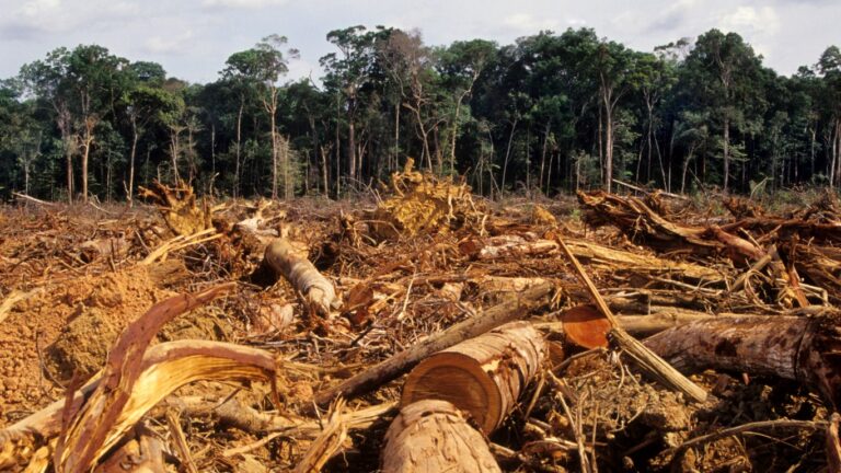
Forests comprise approximately 30% of the Earth’s land area–and those forestlands provide a critical, natural buffer to the effects of climate change. Trees and other forest vegetation filter water, stabilize soil, and store carbon dioxide–the leading driver of human-caused climate change. According to research published by the United Nations, nearly a third of all carbon emissions generated through burning fossil fuels have been absorbed by the world’s forests in the last 10 years.
The United States has a higher concentration of forestland than much of the rest of the world, as forests comprise an estimated 34% of land area nationwide, according to the Sustainable Forestry Initiative, a nonprofit group. But a recent report from the U.S. Forest Monitor–a collaborative research program involving The Nature Conservancy, the Open Space Institute, and the Land Trust Alliance–suggests that forests across the country are disappearing at an alarming rate.
For the purposes of commercial, residential, and cropland development, the U.S. lost nearly 10 million acres of forestland–an expanse roughly equal to the combined land area of Massachusetts and New Jersey–between 1990 and 2017. That amounts to roughly one football field of forest lost every two minutes. The environmental toll of these practices is staggering, as deforestation has resulted in approximately 2.3 billion additional metric tons of greenhouse gases in the atmosphere–roughly equal to the total annual carbon emissions of the European Union.
At the current rate, the U.S. is on track to lose another 39,500 square miles of forestland by the end of the century–roughly the size of all land area in the state of Virginia. Such a loss would also result in another nearly 6.2 billion metric tons of greenhouse gases in the atmosphere. Deforestation is occurring most rapidly in the South, and if nothing changes, several states in the region will lose nearly, or more than, 10% of their unprotected forestland by the year 2100.
Using data from the U.S. Forest Monitor, Climate Crisis 247 identified the states that will lose the most forestland by the end of the century. We ranked all states in the Continental U.S. on the projected total forest loss over the next 75 years using the documented loss rate between 1990 and 2017. All supplemental data, including data used in calculations, are also from the U.S. Forest Monitor.

10. South Carolina
- Projected forest loss by 2100: 1,757 sq. mi. (9.7% of existing, unprotected forest land in state)
- Current rate of deforestation in state: 23.4 sq. mi. per year
- Projected climate burden of deforestation by 2100: 297.4 million additional metric tons of greenhouse gases
- Total projected unprotected forest land by 2100: 16,405 sq. mi. (down from 18,163 sq. mi.)
9. Virginia
- Projected forest loss by 2100: 1,899 sq. mi. (8.9% of existing, unprotected forest land in state)
- Current rate of deforestation in state: 25.3 sq. mi. per year
- Projected climate burden of deforestation by 2100: 327.9 million additional metric tons of greenhouse gases
- Total projected unprotected forest land by 2100: 19,527 sq. mi. (down from 21,426 sq. mi.)
8. Missouri
- Projected forest loss by 2100: 1,905 sq. mi. (7.7% of existing, unprotected forest land in state)
- Current rate of deforestation in state: 25.4 sq. mi. per year
- Projected climate burden of deforestation by 2100: 257.9 million additional metric tons of greenhouse gases
- Total projected unprotected forest land by 2100: 22,935 sq. mi. (down from 24,840 sq. mi.)
7. Mississippi
- Projected forest loss by 2100: 1,922 sq. mi. (6.7% of existing, unprotected forest land in state)
- Current rate of deforestation in state: 25.6 sq. mi. per year
- Projected climate burden of deforestation by 2100: 283.3 million additional metric tons of greenhouse gases
- Total projected unprotected forest land by 2100: 26,875 sq. mi. (down from 28,796 sq. mi.)
6. Alabama
- Projected forest loss by 2100: 2,330 sq. mi. (6.6% of existing, unprotected forest land in state)
- Current rate of deforestation in state: 31.1 sq. mi. per year
- Projected climate burden of deforestation by 2100: 356.0 million additional metric tons of greenhouse gases
- Total projected unprotected forest land by 2100: 32,785 sq. mi. (down from 35,115 sq. mi.)
5. Arkansas
- Projected forest loss by 2100: 2,360 sq. mi. (9.4% of existing, unprotected forest land in state)
- Current rate of deforestation in state: 31.5 sq. mi. per year
- Projected climate burden of deforestation by 2100: 346.5 million additional metric tons of greenhouse gases
- Total projected unprotected forest land by 2100: 22,857 sq. mi. (down from 25,217 sq. mi.)
4. Florida
- Projected forest loss by 2100: 2,447 sq. mi. (13.4% of existing, unprotected forest land in state)
- Current rate of deforestation in state: 32.6 sq. mi. per year
- Projected climate burden of deforestation by 2100: 344.9 million additional metric tons of greenhouse gases
- Total projected unprotected forest land by 2100: 15,857 sq. mi. (down from 18,304 sq. mi.)
3. North Carolina
- Projected forest loss by 2100: 3,022 sq. mi. (12.0% of existing, unprotected forest land in state)
- Current rate of deforestation in state: 40.3 sq. mi. per year
- Projected climate burden of deforestation by 2100: 500.4 million additional metric tons of greenhouse gases
- Total projected unprotected forest land by 2100: 22,073 sq. mi. (down from 25,095 sq. mi.)
2. Texas
- Projected forest loss by 2100: 3,741 sq. mi. (8.1% of existing, unprotected forest land in state)
- Current rate of deforestation in state: 49.9 sq. mi. per year
- Projected climate burden of deforestation by 2100: 536.9 million additional metric tons of greenhouse gases
- Total projected unprotected forest land by 2100: 42,165 sq. mi. (down from 45,905 sq. mi.)
1. Georgia
- Projected forest loss by 2100: 4,400 sq. mi. (12.7% of existing, unprotected forest land in state)
- Current rate of deforestation in state: 58.7 sq. mi. per year
- Projected climate burden of deforestation by 2100: 709.9 million additional metric tons of greenhouse gases
- Total projected unprotected forest land by 2100: 30,263 sq. mi. (down from 34,662 sq. mi.)
More from ClimateCrisis 247
- El Niño Hits California; What to watch For in the weather
- Shade is Scarce in America’s Hottest Cities
- Best Selling EVs So Far This Year
- How Wildfire Litigation Became Big Business in America